
Land of 10,000 Lakes; North Star State; Gopher State
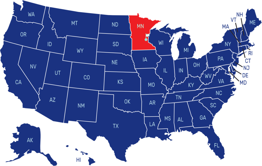
Minnesota is a state located in the Upper Midwest region of the United States. It is bordered by Canada to the north, Wisconsin to the east, Iowa to the south, and North Dakota and South Dakota to the west. The capital city of Minnesota is St. Paul, while its largest city is Minneapolis.
The new flag design to represent the state’s shared history, resources and diverse cultural communities was adopted on May 11, 2024. It replaces a flag with the state seal displayed on a medium blue field. The design is a light blue field with a dark blue angular state shape on the left side bearing a white eight-pointed star.
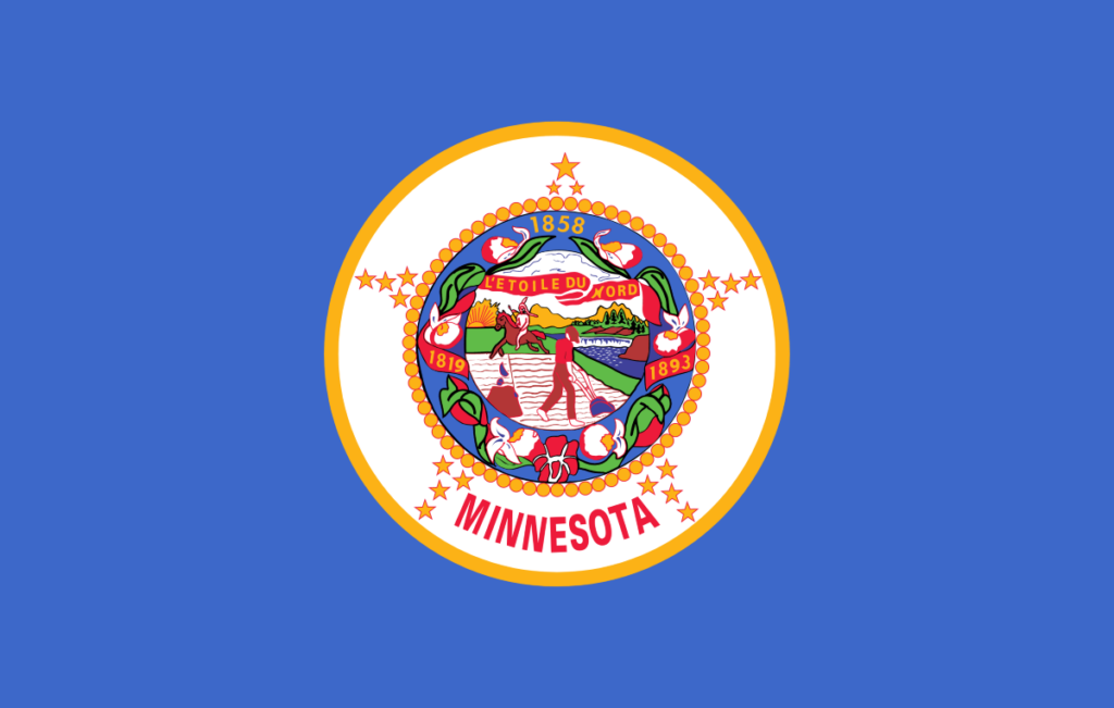
The dark blue represents the night sky and also the shape of the state, the bright blue area relates to the 11,842 lakes, 6,564 rivers and streams found here, while the star represents the North Star, or “L’étoile du Nord,” which is Minnesota’s state motto.
The previous flag featured a royal blue field with the state seal prominently displayed in the center. The state seal depicts a landscape with a farmer and a Native American, representing the state’s agricultural and indigenous heritage.
State Song: “Hail! Minnesota”
Motto: “L’Étoile du Nord” (The Star of the North)
Where is Minnesota on the US Map?

| Capital | Date Admitted to Union | Population (State Ranking) | Area (State Ranking) | Flag Adopted |
| St. Paul | May 11, 1858 (32nd state) | Approximately 5.7 million (22nd largest) | 86,936 square miles (12th largest) | March 19, 1893 |
