
When designing a flag, most countries rely on abstract geometry e.g. stripes, crosses, or stars to represent their land and people. But one flag family skips the symbolism and takes a much more direct approach: putting a literal map of their territory right on the flag.
In vexillology using a map is rare. When a nation chooses cartography over abstract shapes, it is usually to make a statement about unity, geographical pride, or a commitment to peace in a divided region. Let’s unfold the map and explore the rare flags that feature their own borders.
Cyprus: The Island of Copper
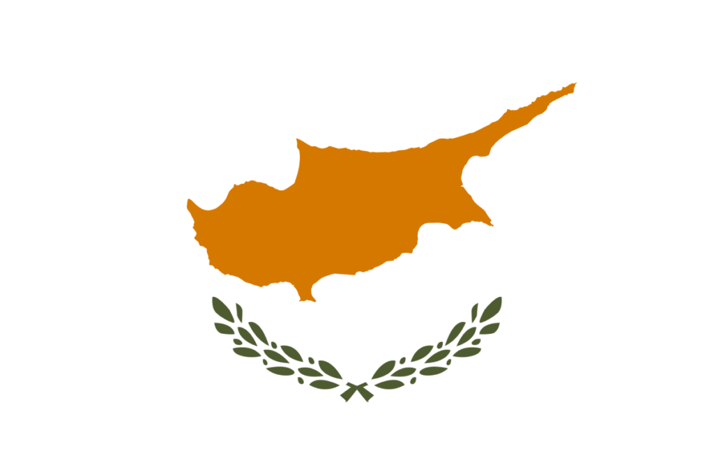
Perhaps the most famous flag in this family belongs to the Mediterranean island nation of Cyprus. Adopted in 1960 when the country gained independence from British rule, the flag features a silhouette of the island above two crossed olive branches on a white field.
The map is orange,representing the copper ore deposits that are one of the country’s major historical resources. Avoiding using any religious crosses or crescents , the map and olive branches were chosen as neutral symbols to foster harmony between the Greek Cypriot and Turkish Cypriot communities.
Kosovo: Stars of Unity
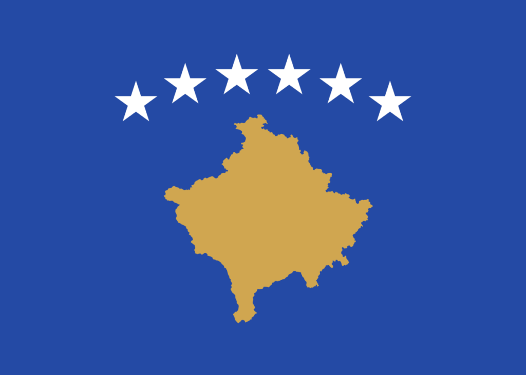
The flag of Kosovo, adopted in 2008 following its declaration of independence, is the only other widely recognized national flag to feature a map of its own territory.
Centered on a dark blue background, a golden map of the nation sits below six white, five-pointed stars. Much like Cyprus, this design was born from a desire for neutrality and inclusion. The six stars represent the six major ethnic groups of the country: Albanians, Serbs, Bosniaks, Turks, Romani, and Gorani.
The Korean Unification Flag: Sporting Diplomacy
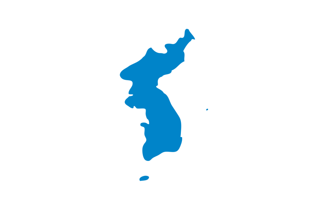
While not the official flag of a sovereign state, the Korean Unification Flag is one of the most powerful map-based flags in modern history.
Designed for the 1991 World Table Tennis Championships, the flag features a simple, light-blue silhouette of the entire Korean Peninsula (including Jeju Island) on a stark white background. It is used when athletes from North Korea and South Korea compete together as a unified team in international sporting events, such as the Olympic Games. It serves as a symbol of hope for future reunification.
Antarctica: The Frozen Continent
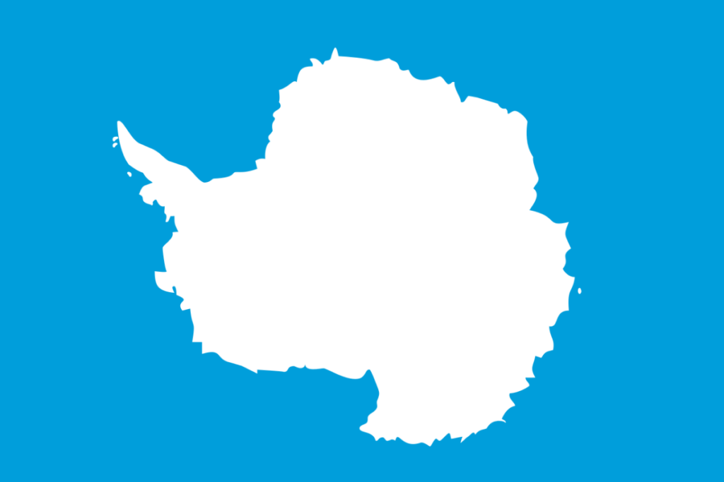
Antarctica is not a country and has no government and doesn’t have an official flag. However, the most widely recognized and flown flag for the continent designed by vexillologist Graham Bartram features a white cartographic map of Antarctica centered on a light blue background.
The light blue mirrors the United Nations flag, representing international cooperation. By using a map, the flag claims no political borders or territories, honoring the Antarctic Treaty system which dedicates the continent strictly to peaceful scientific research.
Stylised Visual Representations of Maps

Not all flags represent a territory with a map outline, some use a more stylised visual representation. Some Japanese prefectures do this, for example the flag of Aomori, uses a large stylised green shape based on the prefecture shape. Ishikawa also incorporates the geographical shape of the prefecture into its design, alongside stylised Japanese characters.
What Maps Tell Us About a Nation
When a flag features a map, it is almost always an act of diplomacy. In regions marked by historical conflict or deep ethnic divisions, choosing a map is a way to say, “This land belongs to all of us.” These flags strip away political and religious icons to focus on the one thing that unites the people: the ground they walk on.
Want to learn more about the incredible history behind the world’s most unique flags? Watch our video playlist below to test your knowledge!