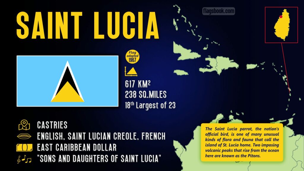
Saint Lucia is an island country located in the West Indies. It is located north of the island of Saint Vincent, northwest of Barbados and south of Martinique. Its official language is English and the capital and largest city is Castries.
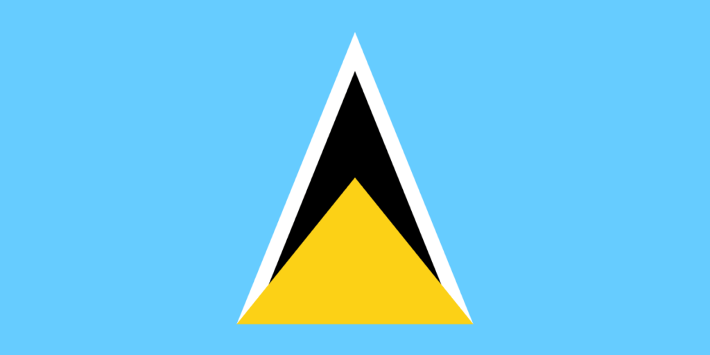
The flag of Saint Lucia was first adopted in March 1967, the latest design being introduced in 2002. The design consists of a pale blue field with a large black isosceles triangle outlined in white at the center overlayed at the base with a smaller yellow triangle.
National Anthem: “Sons and Daughters of Saint Lucia”
| Capital City | Area (World Ranking) | 2022 Population (World Ranking) | Currency | Flag Ratio | Adopted |
| Castries | 617 km² / 238 mi² (194th) | 182,801 (184th) | Eastern Caribbean dollar | 3:5 | 1967 |
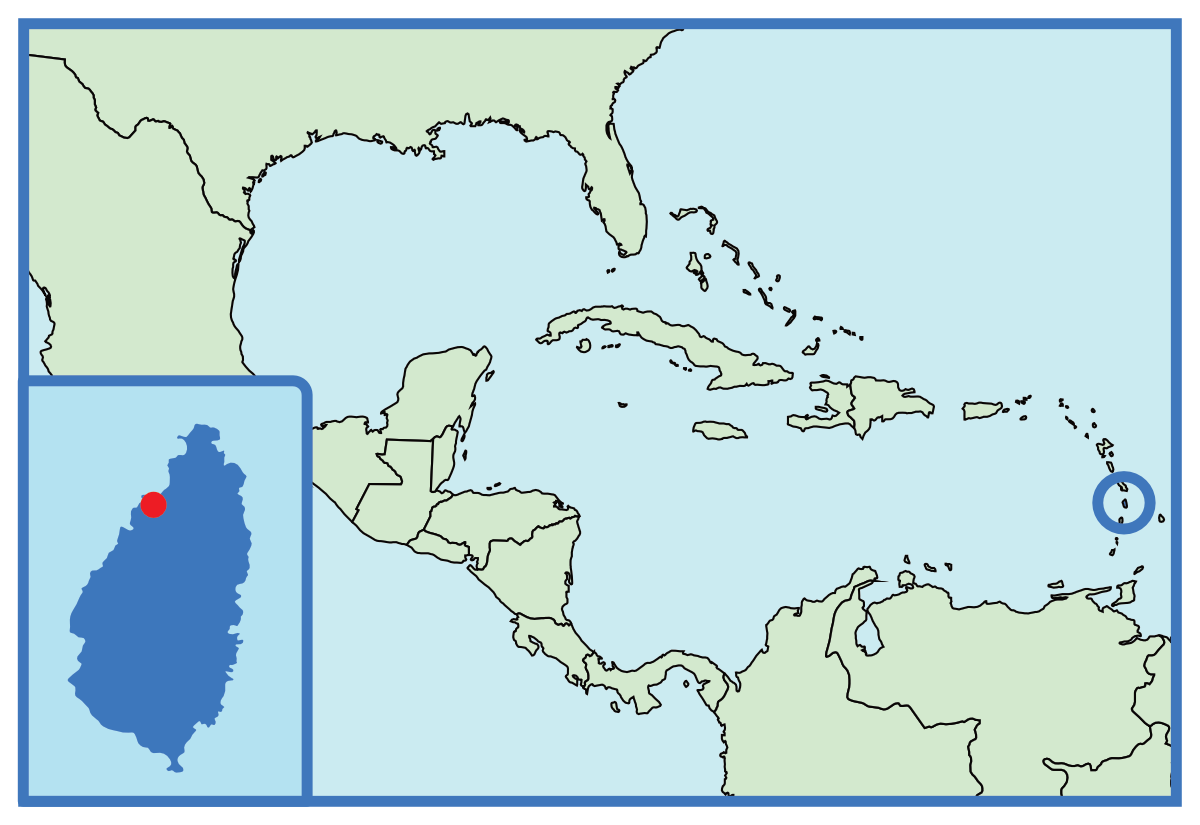
Where is Saint Lucia on a map of North America?