
Land of Lincoln; Prairie State; The Inland Empire State
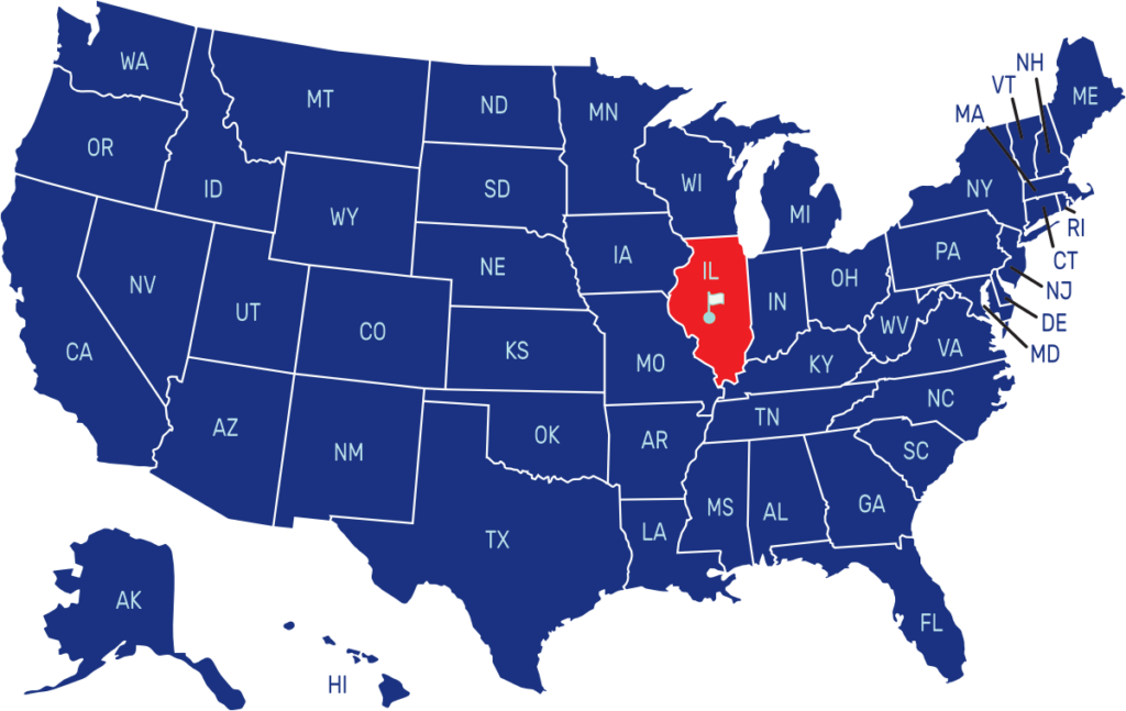
Illinois is a state located in the Midwestern region of the United States. It shares borders with Wisconsin to the north, Indiana to the east, Kentucky to the southeast, Missouri to the west, and Iowa to the northwest. The capital city is Springfield, while the largest city is Chicago.
The flag of Illinois consists of a white field with the state seal above the state name in the center. The seal features a bald eagle holding a sheild with a red ribbon in its beak that reads “State Sovereignty, National Union” The shield has thirteen red and white stripes representing the original thirteen states.
State Song: “Illinois”
Motto: “State Sovereignty, National Union”
Where is Illinois on the US Map?

| Capital | Date Admitted to Union | Population (State Ranking) | Area (State Ranking) | Flag Adopted |
| Springfield | December 3, 1818 (21st state) | Approximately 12.8 million (6th largest) | 57,915 square miles (25th largest) | July 6, 1915 |


