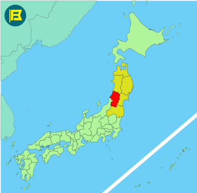
Yamagata is located in the southern part of the Tohoku region on Honshu, covering about 9,323 km², making it the 9th largest prefecture in Japan by area.
Yamagata is bordered by Niigata to the west, Fukushima to the south, Miyagi to the east, and Akita to the north. The Sea of Japan lies along its northwestern coast. The Ōu Mountains run down its eastern side, forming a natural border with Miyagi.
Yamagata City is the capital with a population of about 240,000. Other major cities include Tsuruoka, Sakata, and Yonezawa. It is known for the sacred Dewa Sanzan mountains, Ginzan Onsen hot springs and winter sports facilities at Zao Onsen.
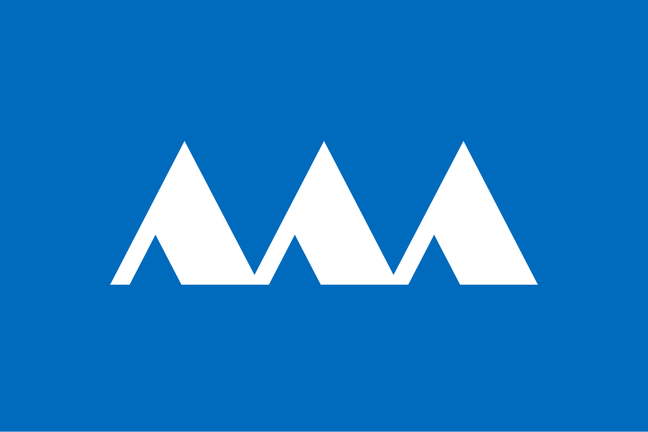
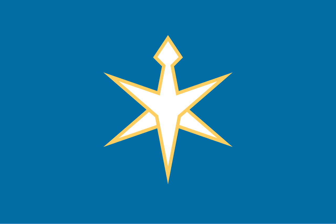
The flag of Yamagata was adopted on August 1, 1964. It shows a stylized “山” (yama) meaning mountain at the center of a mid blue field. The design symbolizes the prefecture’s terrain with the white symbol represents snow on Mount Zaō.

| Capital City | Area | 2023 Population |
| Yamagata City | 9,325.15 km2 (3,600.46 sq mi) | 999,378 |
Japanese prefectural flag designs are used for educational purposes under fair use. Sources include public domain and freely licensed content.


One thought on “Yamagata Prefecture 山形県”
This is going to be incredibly useful for my work.