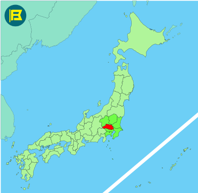
Saitama is located in the southern part of the Kantō region, just north of Tokyo. It covers about 3,798 km², making it the 39th largest prefecture in Japan by area.
Saitama is bordered by Gunma and Tochigi to the north, Ibaraki to the northeast, Chiba to the east, Tokyo to the south, and Nagano and Yamanashi to the west. The Arakawa and Tone Rivers run through this prefecture’s landscape of plains and farmland.
The capital is Saitama City, with a population of about 1.3 million. Other large cities include Kawaguchi, Kawagoe, and Tokorozawa. It is one of Japan’s most populous prefectures with many residents commuting to and working in Tokyo.
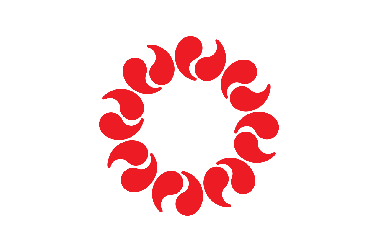
The flag of Saitama was adopted on November 28, 1964. It features sixteen red magatama beads on white field. The beads are arranged to form a circle, symbolizing the sun and strength.

| Capital City | Area | 2023 Population |
| Saitama City | 3,797.75 km2 (1,466.32 sq mi) | 7,338,536 |
Japanese prefectural flag designs are used for educational purposes under fair use. Sources include public domain and freely licensed content.

