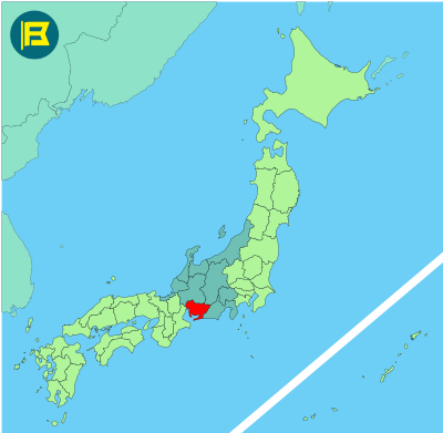
Aichi is located in the Chūbu region on Japan’s main island of Honshu. It covers about 5,172 km making it the 27th largest prefecture in Japan by area.
Situated between the Pacific Ocean and central mountain ranges, Aichi is bordered by Shizuoka to the east, Nagano and Gifu to the north, and Mie to the west
The capital and largest city is Nagoya, Japan’s fourth most populous city, with around 2.3 million residents. Other major cities include Toyota, Okazaki, and Ichinomiya. Landmarks include Nagoya Castle, Atsuta Shrine and Hisaya-Ōdori Park.
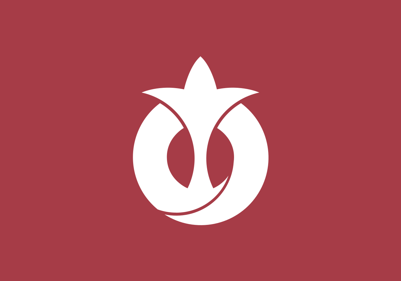
The Flag of Aichi was adopted on August 15th 1950. It features a maroon field with the white hiragana symbols あ,い, ち (Aichi) combined in a circular design representing a hopeful crest of a rising sun wave.

| Capital City | Area | 2019 Population |
| Nagoya | 5,172.92 km2 (1,997.28 sq mi) | 7,552,873 |
Japanese prefectural flag designs are used for educational purposes under fair use. Sources include public domain and freely licensed content.


