

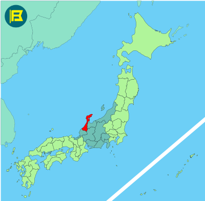
Ishikawa is located in the Chūbu region along the Sea of Japan on Honshu’s northern coast. It covers about 4,186 km², making it Japan’s 34th largest prefecture by area.
Ishikawa is bordered by Toyama to the east, Gifu to the southeast, and Fukui to the southwest. The prefecture also includes the Noto Peninsula, which extends northward into the Sea of Japan.
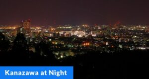
The capital is Kanazawa with a population of about 450,000. Other major cities include Nanao, Komatsu, and Kaga. The total population of Ishikawa is around 1.1 million. Landmarks include Kanazawa Castle and Kenrokuen, one of the three Great Gardens of Japan.
The flag of Ishikawa was adopted on August 1, 1972. It features a white stylized ‘石川’ Ishi meaning stone, forming the shape of the Noto Peninsula. The pale blue background represents the Sea of Japan.
| Capital City | Area | 2020 Population |
| Kanazawa | 4,190.94 km2 (1,618.13 sq mi) | 1,133,294 |
Japanese prefectural flag designs are used for educational purposes under fair use. Sources include public domain and freely licensed content.